Tilston MTS Building

Tilston MTS Building

The 50th anniversary of the Telephone Pioneers in Manitoba (now the MTS Volunteers) was celebrated on June 10, 1988. To commemorate this occasion, Raymond Mills of Stonewall suggested moving the Tilston Central Dial Office (CDO) to the museum. The building and its operating equipment were dedicated in the Homesteaders Village on June 9, 1988.

A CDO is a free-standing telephone building housing switching equipment provide dial service for a specific geographic area. This 23 foot by 23 foot single-storey wood frame building served the 190 Tilston telephone subscribers for over 37 years. It was replaced not because it was worn out but because technology had changed to digital service.

In 1951, the Tilston telephone service was cutover to dial service which eliminated the manual magneto service and the telephone operators. In 1951 the dial service required only three digits for the area but was changed in 1962 to seven digits ANC (All Numbering Calling) in preparation for DDD (Direct Distance Dialing). This allowed telephone customers to dial up any other number without going through an operator. Tilston numbers had the prefix of 697-xxxx.

Telephone service on the Agricultural Museum site, Austin MB – The Pole Line

On September 10, 1983, a telephone pole line was dedicated on the Agricultural Museum site at Austin Manitoba. This 12-span pole line would provide a means of communicating between buildings along Main Street in the Homesteaders Village.

This was no ordinary pole line. It had started its service life in the Rathwell area as part of the Trans Canada Telephone System (TCTS). TCTS was completed in 1932 by seven Canadian telephone companies. This revenue bearing facility allowed long distance telephone calls from sea to sea to be made entirely on Canadian soil. Previous to this, telephone calls across Canada would have to be routed into the United States then back into Canada to be completed.

The poles were high quality Group II Western red cedar 30’ high. The cross arms were 4” x 5” x 10’ long Douglas Fir. The pins supporting the insulators were of steel rather than oak. The insulators were Toll line #22 Pyrex and the open wire was #8 or bull 8 copper.

This was not the first change of service for this pole line. The advent of plastic insulated cable and microwave technology had replaced open wire for Toll networks in the 1950s and 1960s. This section of pole line was then repurposed for service to rural subscribers and now it would provide service for the Agricultural Museum.

The donation of the pole line was a project suggested and installed by Eastern Region employees. It coincided with the 75th anniversary of MTS and was to preserve a section of the old telephone facility in an historic location. Attending the ceremonies in addition to dignitaries was retired telephone lineman George Ardagh from Austin and Dan Bergson from Gladstone.

Best wishes were expressed by MTS in recognition of the importance of the pole line. United Nations Secretary – General  Javier Perez de Cuellar sent a letter in honour of World Communication Year. His comments read as follows: “The role which the Trans-Canada Telephone System has played in the advancement of your country bears witness to a critical link between communications and development.  May I take this opportunity to express the hope your exhibit will serve not only as witness to your important accomplishments but will help to focus attention on the steps which other countries of the world have yet to take.”

September 10, 2016 marks 33 years that the pole line has served the Homesteaders Village and 74 years of continuous telephone service.

Dedication ceremony officials: Terry Farley ( Museum), Ed Tinkler (MTS), Eugene Kostyra (MB Gov’t), George Ardagh (MTS), Gordon Holland (MTS), Unknown
Dedication ceremony officials: Terry Farley ( Museum), Ed Tinkler (MTS), Eugene Kostyra (MB Government), George Ardagh (MTS), Gordon Holland (MTS), Unknown
75th Anniversary plaque unveiling Eugene Kostyra and George Ardagh

Union Masonic Lodge No. 108

Masonic Lodge No. 108

This is a brief history of the formation of a Masonic Lodge later to be known as Union Lodge No.108.

In the Brookdale district prior to 1907, two members of the community: H. C. Smith, station agent, and R. B. C. Thomson MD, being Masons themselves and there being no lodges closer than Neepawa and Carberry, decided to canvass not only the Brookdale district but the surrounding districts, Moore Park, Justice, Oberon, and Wellwood, to find enough interested people to form a Masonic Lodge. This was done and the following persons besides the original two expressed a desire to join: Mr. Beeman, Mr. Hughes, Mr. Phil McRae, Mr. H. Leslie, Mr. T. Ballantyne, and Mr. H. Allen.

Their application to the Grand Lodge of Manitoba was approved and the D.D.G.M. of District Number 2, a Mr. McIntosh, was instructed by the Grand Master of Manitoba to institute a lodge on July 26, 1907, to be known as Union Lodge No.108. The word ‘Union’ recognized that several districts were represented in the membership.

At the first meeting July 26, 1907, a total of four petitions for initiations were received, besides the eight founding members. Before the end of the following year, 14 more petitions were accepted.

The first year was a very successful one with Grand lodge approving the work done and the progress made. Accordingly on June 10, 1908, a charter was granted and the lodge officially designated as Union Lodge No. 108 AF & AM.

The lodge, on the authority of the Grand Master Most Worshipful Brother H. J. Pugh, instructed the District Deputy, Right Worshipful Brother William Dickie of District No.2, to officiate at the constitution on the above date, of Union Lodge No. 108.

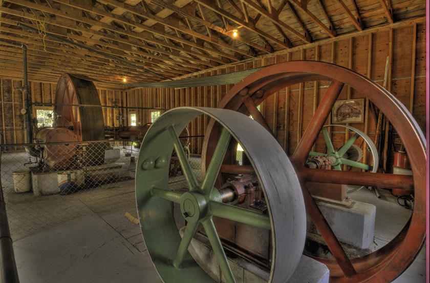
The lodge, not having a permanent building, held its meetings in the upper classroom in the school, from 1907 until 1916.

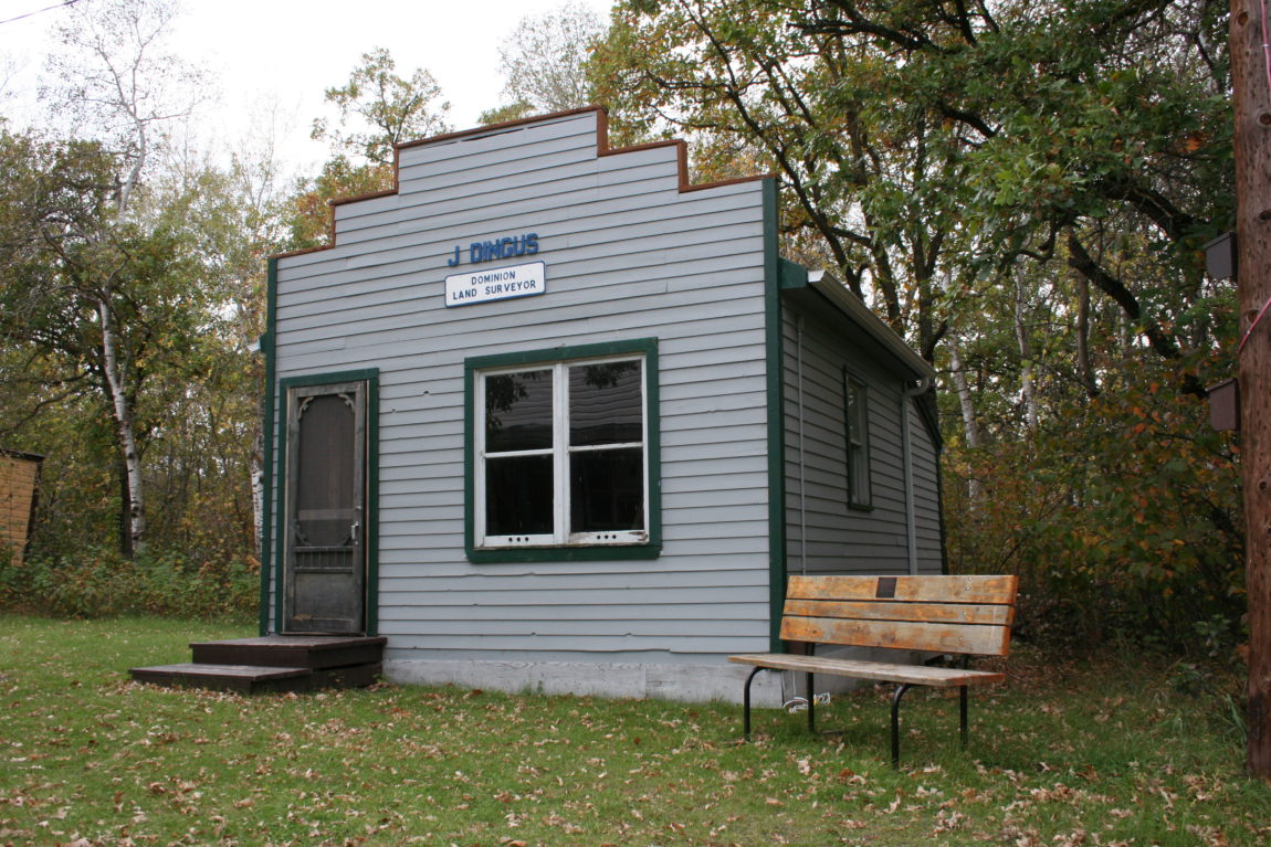
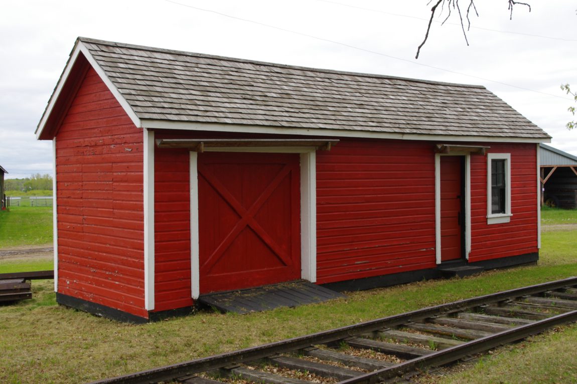
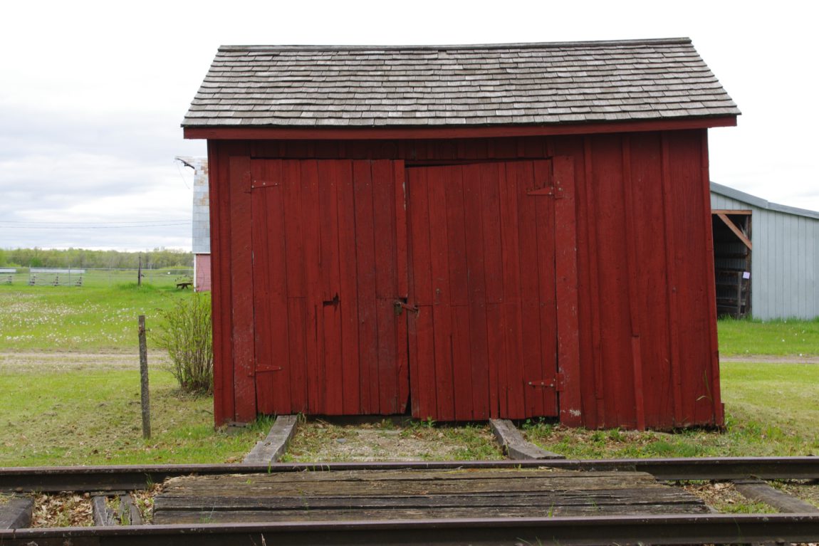
According to a Brookdale history book, this building was originally a bake shop, then a harness shop. In 1916, the building became available and was acquired by the Lodge for the sum of $470, which included some repairs. After extensive alterations, the upper part was used as a lodge room with an outside entrance, and the ground floor was rented out, providing a small source of income.

In 1928 the lower hall was taken over for a lunch room and recreational purposes. It was also made available to the community or groups such as the Red Cross and 4-H, free of charge. The “no charge” rule was imposed by the municipality, and in return the hall was not liable for property taxes. This policy ended several years ago.

The Order of The Eastern Star has had the facilities made available to its members since its founding in 1953.

From the years of its establishment in 1907, the lodge has had a steady growth in membership, due in part to the fact that it was the closest lodge available for several districts.

Membership has remained fairly constant over the years, with enough new members coming in to compensate for those moving away or passing away.

It should be mentioned here, that the lodge has appreciated the fact that the majority of the members who have moved away, have maintained their membership in their Mother Lodge.

In all jurisdictions, the smaller lodges, including ‘Union’, are having problems keeping their lodges going due to the high cost of taxes, heat and light. There are more demands too, on the members’ time and money in the community. Union Lodge, we hope, will be able to cope with these many problems.  We have survived our 50th, our 75th, and hopefully look forward to our 100th anniversary.

We are indebted to many members down through the years who have contributed to the lodges’ well being. (The foregoing was written by R.M. Mikkelson for the Brookdale Centennial Celebration book)

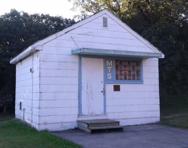
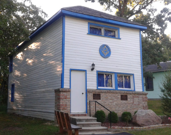
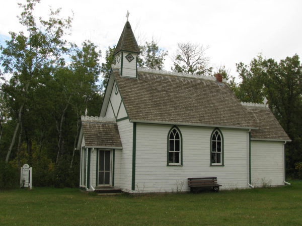
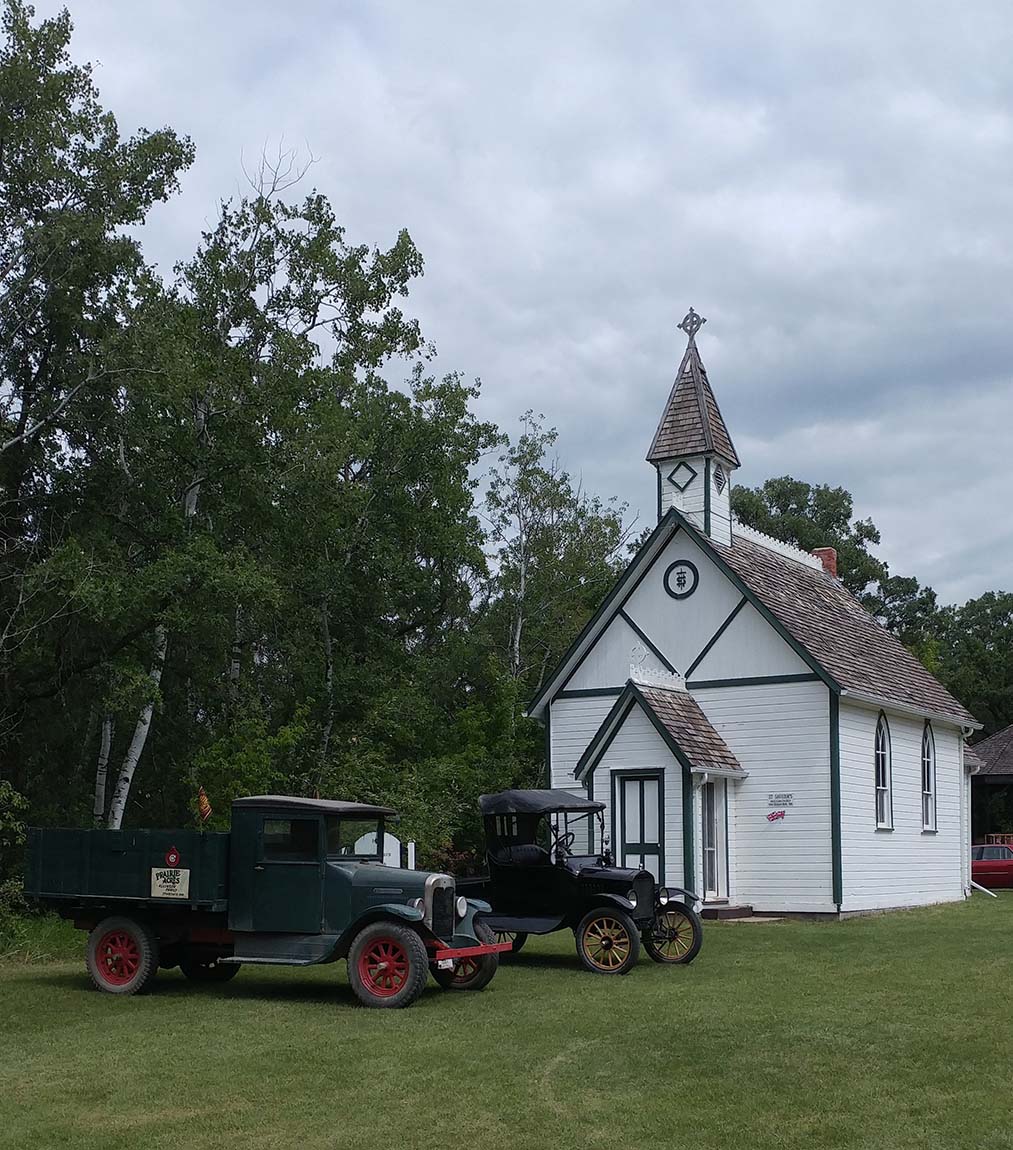
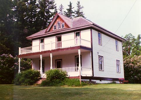
In 1986 Union Lodge decided to give up their charter as an active lodge on the Registry of the Grand Lodge of Manitoba. R. W. Bro. Alvin G. Hewitt was the District Deputy Grand Master of District 2 at the time, he and several brethren of the District decided to have the lodge moved and placed as a working lodge on the street of the Manitoba Agricultural Museum. Negotiations got under way with the Board of the Agricultural Museum and with the Board of General Purposes of the Grand Lodge of Manitoba. An agreement was reached and a small group started on the project of fund raising. The Masons of Manitoba were most generous in their support and in a very short time the building was moved from the Town of Brookdale to the grounds of the Manitoba Agricultural Museum.

It took many hours of work by a few dedicated Masons to strip the old siding from the building, place new siding, pour a new foundation and strip coats of paint from the interior surface.  The lodge room was repainted as near as possible to the original colour, the carpet on the floor of the lodge room was donated courtesy of Strathcona Lodge No. 117 at Belmont, Manitoba, which amalgamated with Glenboro Lodge No. 48 on 30 June 1988.

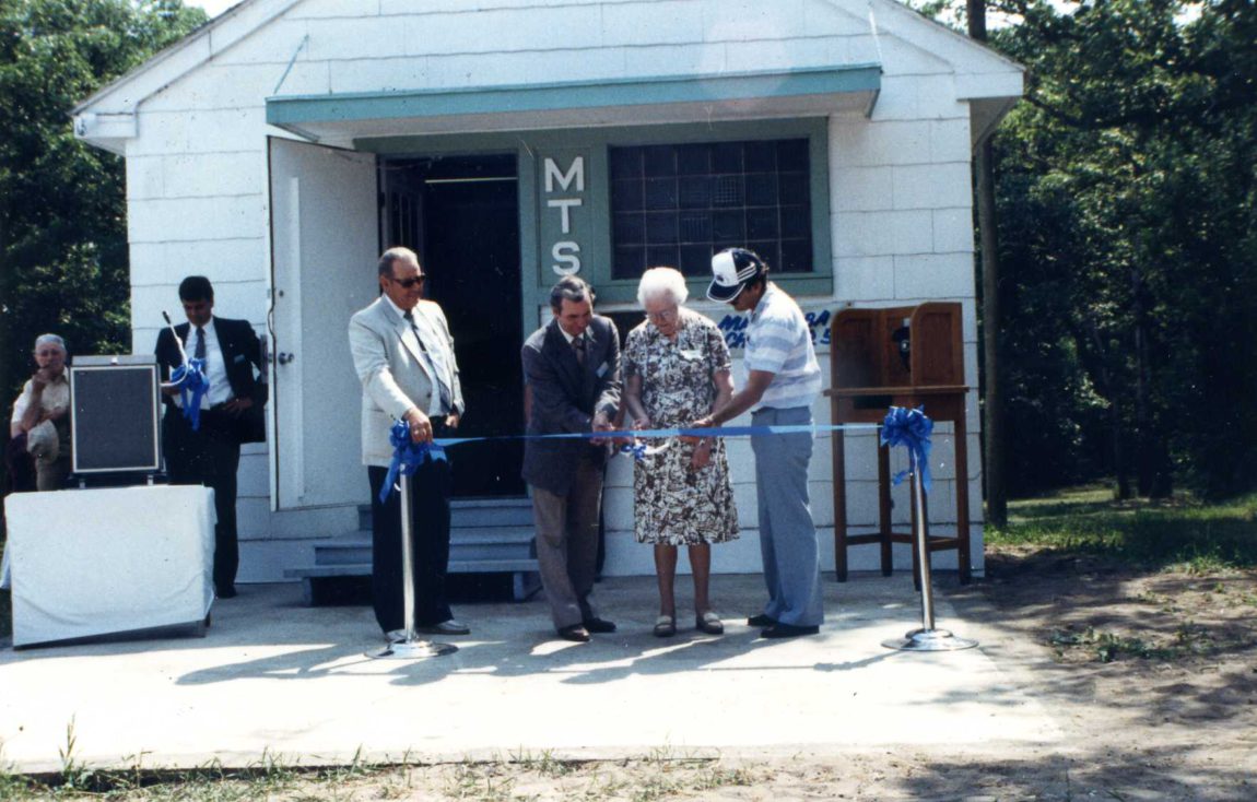
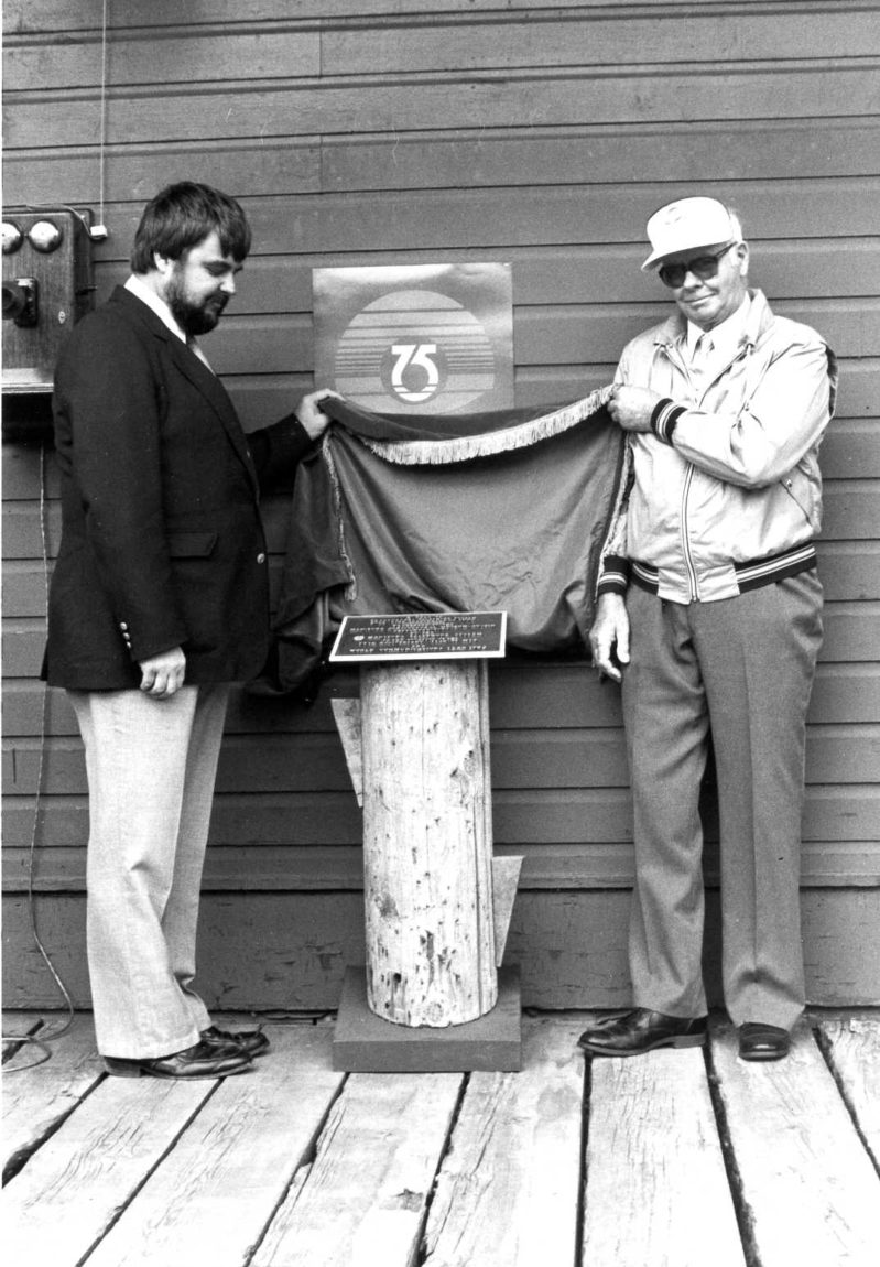
On July 25, 1992, Most Worshipful Brother Morley J. McKay and Grand Lodge officers formally dedicated the building and placed the bronze plaque on the outside wall near the front entrance door.

An Emergent Communication was held 13 July 1994 under the guidance of Most Worshipful Brother W. Bruce Porter, Grand Master of the Grand Lodge of Manitoba, for the sole purpose of reconstituting the Lodge as “Union Historical Lodge No. 108” on the register of the Grand Lodge of Manitoba. The original Charter of Union Lodge, properly endorsed, now hangs in this building.

On July 13, 1994, Union Historical Lodge No. 108 was opened in the Three degrees of Masonry by the Grand Master, M. W. Bro. Bruce Porter and his Grand Lodge officers for the purpose of re-instituting and re-constituting Union Historical Lodge # 108. This service was performed in a most capable manner by those officers.

Union Historical Lodge No. 108 meets in this building on the last Friday of May and the last Friday of September each year. Any Mason in good standing in any Lodge in the world, providing his jurisdiction is recognized by the Grand Lodge of Manitoba, may join this Lodge. The fee is a once in a lifetime fee of $50. The fees are used to help in maintaining the building. The fee is payable to: Union Historical Lodge No. 108  Attn.Secretary, 52 Tupper Street South, Portage la Prairie, Manitoba, R1N 1W6.

I shall pass through this
but once,
If, therefore, there is any kindness
I can show,
or any good
I can do my fellow being
Let me do it Now!
Let me not deter
Or neglect it
For I shall not pass
This way again.

Frequently Asked Questions

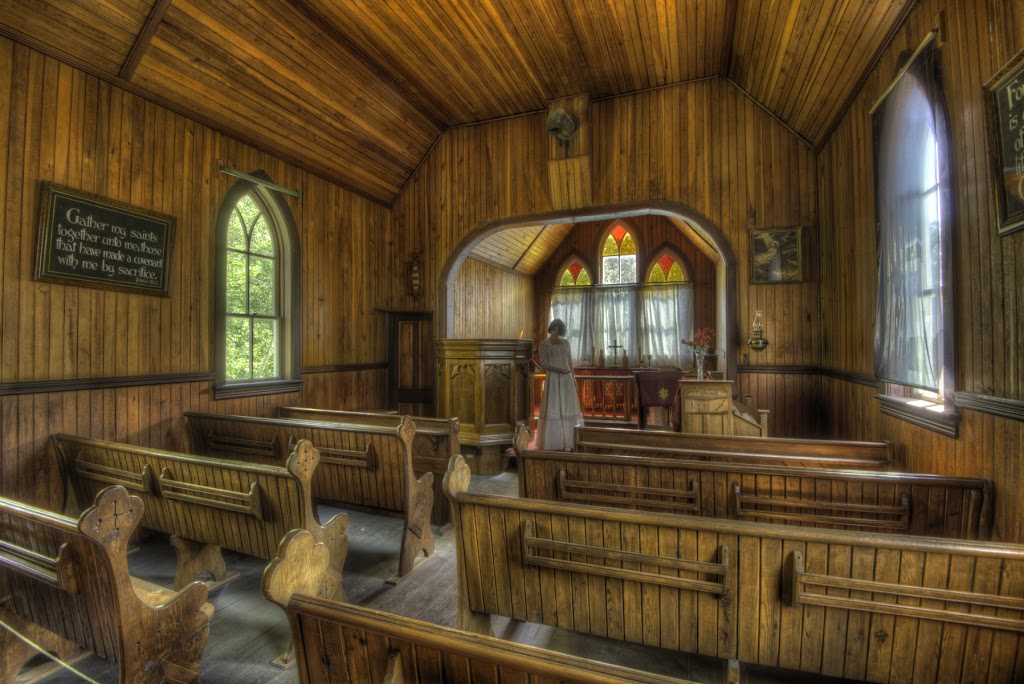
Why are the tassels hanging in each corner of the room?

They represent the four Cardinal Virtues, Temperance, Fortitude, Prudence and Justice. Temperance reminds one to keep excessive appetites within due limits. To be temperate in all your actions. In days past, in some lodges, it meant abstinence from alcohol. Fortitude suggests we should bear the ills of life with becoming resignation, do not let life wear you down. Prudence is the true guide to human understanding, be courteous with words and speak with propriety. Justice suggests we should keep our feet firmly planted on the ground in an upright manner. Treat all people equally and with respect.

What does the letter G represent?

The letter G represents God, the Grand Geometrician of The Universe and usually hangs over the Volume of The Sacred Law or Holy Bible. Each Mason must believe in a Greater Power, atheists are not accepted into the fraternity.

Why are the square and compasses on the walls?

They are indicative of the working tools of an operative mason and in the Lodge the square remind us to square our actions by the square of virtue and the compasses to remind us to practice brotherly love, relief and truth. In our world today many are concerned about the bitterness and hate that is so prevalent in human affairs. About the weakening of moral standards, disrespect for the laws of society and for the rights of others. Everywhere there are individuals and groups that are striving to maintain decent standards in society and to preserve those ways of life that are founded on justice and integrity. Freemasons are also concerned about these things, and hope to add their influence in protecting the honour and dignity of human life.

Freemasonry stands for kindness in the home; courtesy toward others; dependability in one’s work; compassion for the unfortunate; resistance to evil; help for the weak; support for education; and above all, a reverence for God and love of fellow man.

Surveyor’s Office

Surveyor's office
Surveyor's office

Welcome to a typical survey office from the late 1800s. It was from an office like this that surveyors managed the surveys of lands within early Manitoba. The earliest surveyors were men like David Thompson, Samuel Hearne and Peter Fidler who, equipped only with a sextant, trekked across the vast wilderness, observing the stars to determine their location and then drawing maps for use by their employers, the Hudson Bay Company and the North West Company. Later land surveys were made to establish lots for the settlers of the Red River Colony. These “River Lots” were narrow strips of land running at right angles to the river in order to address concerns for the welfare and protection of the early settlers in the isolated colony. The river frontage also provided ready access to the transportation arteries of the day. With the acquisition by the Dominion of Canada from the Hudson Bay Company of the huge tract of land known as Ruperts Land, the extension of confederation into the West could now begin. Faced with an anticipated massive and sudden settlement of the new lands and the need to manage it in an orderly and controlled manner and avoid the many problems inherent in a “land rush”, the Government determined that a simple and straightforward survey system was needed.

Survey map

As a result, the survey and mapping of the new lands became a high priority. The system adopted was composed of 36 square mile Townships, each subdivided into 36 one mile square Sections of 640 acres each. Please see the attached Township Diagram of Township 11 Range 11 West. The Museum is in the West ½ of Section 17. The new system was to abut the existing River Lots and was to be referenced to a Principal Meridian which was established from a point on the International Boundary approximately 10 miles West of Emerson.

Between the years 1870 and 1885, millions of acres of Western Canada were surveyed and “posted”. This involved the placing of thousands of survey monuments. These early survey monuments consisted of a mound and 4 pits with a wooden post and were positioned at the intersection of the Northern and Eastern boundaries of each Section with the “Quarter lines” which divided each Section into 4 Quarter Sections of 160 acres. Into each post was carved the particulars of its location in the Section as well as its Township and Range reference. In later years the wood posts were replaced with iron posts which were stamped with the same kind of information. This information allowed settlers to readily identify the location of their new homesteads and to provide certainty when applications for Crown Grants were made. Samples of many of the types of monuments used over the years are on display here as well as a typical mound and pits which have been built just behind this building.

A major part of the settlement and development of the West was the construction of the trans-continental railroad. Suitable locations along the route were used as centers for the railway construction workers and engineers. Many of these sites gradually developed as people settled there and began working for the railroad or in related business. Surveys were carried out to create lots for these homes and businesses. Many of these early settlements still exist today with a common thread being the numerical street designations and the familiar “North and South Railway Avenues” linked by a “Main” or “Center Street”.

The methods and tools used in surveying have greatly changed over the years: the 66 foot “Gunters” chain and theodolite have been replaced by electronic equipment called Total Stations which measure distances and angles and digitally record the gathered information. Positioning on the ground by observations of the stars now mostly relies on man-made satellites and Global Positioning System (GPS) equipment.

The responsibility for surveys and surveyors, while originally the responsibility of the Dominion Government in support of the Property Rights system (Letters Patent and Crown Land Grants), now rests with the Association of Manitoba Land Surveyors, founded in 1881 under Provincial legislation to support the Provincial Real Property Act (Certificates of Title) and the Registry Act (Deeds to land) in Manitoba.

Additional information is available on the Manitoba Land Surveyors website.

Katrime Freight and Passenger Shelter (1919)

Katrime Freight and Passenger Shelter

This small railway station was originally located at Katrime, Manitoba which was on the CNR rail line from Portage to Gladstone. This rail line was built in 1910 as joint effort between the Canadian Northern Pacific (CNoP) railway and the Northern Pacific and Manitoba (NPM) railway. CNoP built the Katrime station in 1919. In 1923 the CNoP was absorbed by the Canadian National Railways.

The Katrime station is an example of the CNoP’s Standard Freight and Passenger Shelter, plan 100-41. Some alterations have occurred over the years, most notably the removal of a window in the freight end of the building.

By the 1960s railway operations had changed significantly and Canadian railways were disposing of rural stations. Katrime was no exception however instead of demolition the station went on to a second life as a railway tool shed. With rationalization of railway maintenance, the CNR decided it had no need of a tool shed at Katrime. The building was sold and moved to a farm near MacGregor. In 2002, the owners had no further use for the building and offered it to the Museum. It was moved to the Museum and rebuilt to the appearance it had when it was last used at Katrime as a Freight and Passenger Shelter.

These small stations are often known as “portables” as they were deliberately designed to be easily moved. Portables were used by all Canadian railways, often in the construction phase of a rail line. They were set up at sites identified by the railway as potential town sites and served as a station until the line was completed and a permanent station could be built. Railways concentrated on completing the track and usually left the construction of permanent buildings, such as stations, until later. If the railway was not sure whether the prospects of the site warranted a permanent station, then the portable would be left in place until the prospects for the site became clear. At some locations business did not materialize and the stations were moved elsewhere. In other locations, such as Katrime, low levels of business warranted only a portable station over the life of the location. Often there was no station agent at portable stations. People using the station set out flags to alert train crews that there were passengers and / or freight waiting at the station for pickup. Fares were collected and billing paper work was completed by the train conductor.

In total, the CNoP erected at least 343 plan 100-41 stations between 1910 and 1923 when the CNoP was formally rolled into the Canadian National Railways. CNoP used a different design of Freight and Passenger Shelter stations before 1910 and so the total number of the portable stations built by the CNoP is far higher than 343.

The Canadian Northern Pacific Railway got its start when a railway construction contractor by the name of Donald Mann was looking for work in the early 1890s. He became interested in a charter for a railway, the Lake Manitoba Railway and Canal. This railway was meant to connect Lake Manitoba to Portage La Prairie. Then a water connection could be made to Prince Alberta via the Lake and the Saskatchewan River. After various negotiations including exploring the idea of building a rail line to Hudson Bay to export grain, what emerged was a railway from Gladstone to Dauphin. Mann by this time had acquired a partner, William McKenzie and they formed the CNoP. To connect Gladstone with Winnipeg, the partners arranged running rights on the Manitoba and Northwestern Railway (MNW) which ran from Portage to Minnedosa and beyond. However the MNW was not profitable and was sold to the CPR in 1900. This line became the foundation for CPR’s Portage to Edmonton route.

The CNoP decided it needed it’s own connection with Portage and struck an arrangement with the NPM to build the line. CNoP built a line from Gladstone to Beaver, Manitoba in 1901. The NPM built a line from Portage to Beaver where the two lines connected. Later in 1901, NPM was sold to the CNoP and the entire Gladstone to Portage line became CNoP property.

Just exactly why the NPM agreed to build the Beaver to Portage line is more understandable when one realizes that the NPM was in the hands of the Manitoba government at the time as the Northern Pacific Railway (NP), a parent of the NPM wanted out of the NPM as it was a money losing operation. NP turned over its interest in the NPM to the Manitoba government in 1900. The government had no real interest in operating railways but the people of Manitoba were demanding more branch lines and cheaper freight rates. CNoP was able to do both. Probably the government was willing to build the Beaver to Portage segment as they wanted to encourage the CNoP and in any event the government knew it would soon be selling the line to the CNoP anyways.

CNoP purchased the ex-Northern Pacific and Manitoba railway from the Manitoba government and combined these lines with the Portage to Dauphin line and the rail line they had built running to the southeast of Winnipeg. They went on to purchase a rail line in Saskatchewan running from Regina to Price Albert plus built more branch lines and a line to from Winnipeg to Fort William on Lake Superior. The CNoP with its significant rail network on the prairies played a very large part in facilitating the agricultural development of Manitoba and the prairies through provision of transportation services.

However, the company realized that it was at the mercy of the CPR as the CNoP depended on the CPR to access the ports and markets of Eastern Canada and the Port of Vancouver. The CNoP then determined to build into Eastern Canada and to Vancouver. Both of these destinations involved expensive construction in crossing Northern Ontario and the Rocky Mountains. Both these areas also generated little traffic to help pay the expense of these lines. To make financial matters worse just as the CNoP lines were being completed to the east and west, World War One had broken out and interest rates climbed significantly. Mann and McKenzie had financed the CNoP using borrowed money largely and rising interest rates were a very heavy blow. As some of the CNoP’s commerical loans were secured by Government of Canada guarantees and the government had also taken CNoP stock as guarantee on government loans to CNoP, the Government of Canada was very concerned with the financial position of CNoP.

The Grand Trunk Pacific (GTP) Railway was also experiencing significant financial problems as well. In 1917, the Government of Canada decided nationalization of both railways was the only possible option and took over both. In nationalizing the GTP, the Government also decided GTPs parent, the Grand Trunk (GT) railway, also had to be nationalized. The legal and financial arrangements took some time however by 1923 the Canadian National Railway had emerged.

It is interesting to note that Mann and MacKenzie had a substantial investment in the Western Canadian Flour Mills Company which orginally built the elevator now on the Museum grounds.

Canadian Pacific Railway Toolshed

CPR Toolshed
CPR Toolshed

This very simple little building served as a tool storage shed for the section crew which maintained the Canadian Pacific Railway (CPR) mainline around Austin. The shed was located in Austin.

This building has a number of features which point to an early construction date. This building features board and batten siding.  Board and batten siding consists of boards nailed on vertically and flat against the buildings framework. The joints between the boards are then covered with a narrower board, the batten, which is nailed over the joint. Board and batten construction was very common in Pioneer Canada before 1900. One advantage of board and batten was that it could make use of varying widths of boards and the edges did not have to be perfect as the battens were 2-4 inches wide.  Board and batten construction on the railways seemed to have fallen out of use by the 1890s.

As well, the tool shed features rough sawn 2 x 4 framing, that is the 2 x 4s were not planed and so are the full 2 x 4 dimension. Rough sawn materials were also commonly encountered in Pioneer Canada construction and began to become uncommon after 1920 as the technology of lumber planers improved and the advantages of planed lumber became apparent.

Given the construction which points to a construction date before 1900, it is quite likely this tool shed was the only tool shed ever constructed at Austin. While the CPR track was completed coast to coast in Canada by 1885, it took at least another 10 years to bring the CPR up to full operational standard with the provision of railway buildings and facilities plus ballasting of track and filling in of trestles with earth where practical.

By 1995, track maintenance had changed significantly with maintenance forces being provided with trucks to move around with. The tool shed at Austin was no longer needed and so was offered to the Museum.

It is interesting to note that a CPR diagram exists inside the tool shed that lists the tools that should be in the shed and stipulates where they are to be stored. This indicates standardization of tool sheds and their contents. Probably this was done so that almost any CPR employee could enter the tool shed and quickly locate the tool needed or just as quickly determine it was not in the shed. Of course, this assumes the section gang followed the diagram.

Section gangs were a fixture on rail lines up to the 1970s. Lines were divided up into sections and assigned to specific gangs. Each gang maintained the track, replacing ties and damaged rails, maintaining road crossings, signage along the track and other tasks in their section. Often the section crew lived in a bunk house located alongside the track. The foreman usually lived in a house owned by the railway which was also located along side the track, the so called section house. Steam locomotives, for various reasons, were hard on track which resulted in a need for ongoing maintenance. Diesel locomotives were easier on track resulting in less maintenance. As well, track maintenance became increasingly mechanized through the 1960s. Section gangs began to disappear in the 1970s and were replaced by crews that cover much greater sections of track. As well travelling crews with specialized machinery travel the country doing such jobs as replacing the rail or ties in sections of track.

Section gangs offered local employment opportunities to farmers and their sons. As well remaining on good terms with the local section gang was advisable as the gang was equipped with heavy jacks, chains, cables, timbers and other items which farmers of the time had the occasional use for. If the farmer could borrow the item from the gang, he could avoid purchasing the thing or going further afield to borrow one.

MacGregor Water Tower (1900)

MacGregor water tower

This water tower was originally built by the CPR at MacGregor and donated and moved to the Museum in 1987. It is the only water tower known to have been moved.

When rail lines were constructed through Manitoba, the railways had to construct water towers along the lines as steam locomotives needed water on a regular basis. These tanks were constructed at regular intervals along rail lines These towers held about 40,000 gallons (about 180,000 litres) of water and would enable the locomotives to fill quickly and frequently.

In most cases, water had to be pumped into the water towers from a lake or creek.  At times the railways had to construct significant facilities to supply water to the track side tanks. The MacGregor tower was gravity filled from Jacksons Lake, seven miles south of Sidney, some 15 miles from MacGregor. In other cases, dams were built on creeks or rivers to assure the railway of an adequate supply.

The tower is 54 feet high and consists of two separate structures. The 40,000 gallon inner tub is made of 3″ thick cedar and is supported by 16′ square timbers, 22′ high in the air. The height provides the gravity pressure needed to fill the locomotives.

The outer shell, which is not attached to the tub, simply serves as an insulated cover for the water. By having a stove at the bottom of the building during the winter months, the outside shell would prevent the water from freezing. It was quite common that railway water towers in eastern Canada did not have the outer shell as winter weather was not as severe as in Western Canada. These outer shells were not often found on US railroads either as these roads were further south enjoying warmer winter weather.

CPR and CNR wooden water tower designs were quite similar. Apparently the CNoP, a predecessor to the CNR, and the CPR had a close relationship with each other when the CNoP first appeared as MacKenzie and Mann, owners of the CNoP, had been very reliable construction contractors for the CPR. They were able to borrow a number of building plans from the CPR which partially explains why CPR and CNR buildings in the west often appear quite similar.

Westbourne Post Office (1902)

Westbourne Post Office

The Westbourne post office was constructed by E. A. Smalley who was the post master for 35 years. This office used to handle all the mail for northwestern Manitoba when it was still the “postage stamp” province. The building was moved to the Homesteader’s Village in 1972 and was restored and opened to the public in 1973.

The post office is authentically furnished with original mail bags, roll-top desk, coal oil lamps and an ornate cook stove with a jug on top for boiling coffee. The postmaster, Mr. Smalley, was so short that he had to use a chair to stand on so he could see through the wicket.

Inside Westbourne Post Office

The heavy white canvas bag was durable enough to endure the train ride. It was quickly fastened, taken to the train station and dumped on the platform.

From 1870 to 1885, postal service in Canada was rather hit and miss. Mail was often delivered by hand and it was not uncommon for a letter to take a year to arrive. In 1885, the completion of the Trans-Continental Railway improved postal service not only at Westbourne but also throughout the Dominion.

Manitoba when it joined Confederation in 1870 was only 1/8 the surface area than it is today. As it was relatively small and square it was known as the “postage stamp” province. The Provincial boundaries were expanded in 1881 and again in 1912 when it achieved the boundaries it has currently.

Souris Mill

Souris Mill
Souris Mill

The Souris Mill engine is housed in a replica building along the street of the Homesteader’s Village. The engine, not only operated the mill in the pioneer community of Souris (first known as Plum Creek) but also turned the economy of that Manitoba town for many years. In the years ahead, the Souris Mill was to become one of the largest flour mills in Canada.

Souris Mill Building

Squire Sowden, who was responsible for the building of the swinging bridge in Souris, wanted to build a mill. When George McCulloch and William Herriot arrived at Plum Creek in 1882 to see how the proposed mill was progressing, practically nothing had been accomplished. The machinery for the mill had been ordered from the firm of Goldie and McCulloch in Galt, Ontario. It had been delivered to Brandon in the fall of 1881 and left by the railway track abandoned. The Company had grown tired of a series of fruitless attempts as to the fate of the equipment and sent McCulloch and Herriot to find it. After building a shelter for the machinery in Brandon, the two men proceeded to Plum Creek. Here, they were impressed more by the possibilities for the proposed mill than by progress.

After looking at the material already assembled, McCulloch and Herriot decided to take the project on themselves. A large number of carpenters and workers were immediately dispatched and by the end of December 1882, the first mill in Souris was erected and ready for operation in February 1883. A few years after construction of the new mill, the 3 McCulloch sons – Hugh, Dick and Bill – were in charge of what was equal to the largest flour mill in Canada. The engine and flour mill ceased to operate in Souris around 1926 and was to remain idle until 1976. It is fully operational during Reunion with it’s 185 H.P., two cylinder engine which is powered by steam from a boiler outside. The boiler pressure is 120 lbs. per square inch. The large flywheel turns 75 times per minute. It weighs 7 tons and is 14.5 feet in diameter. The belt is made from 52 cowhides and is 3 layers thick. With a load on the mill, about 8.5 tons of coal is used in 24 hours, necessitating a fireman constantly. Output of the mill was 350 barrels of flour per 24 hour day, consuming 1600 bushels of wheat and producing 700 bags of flour.

St. Saviour’s Church

St. Saviour's Church 2007
St. Saviour’s Church 2007

St. Saviour’s Church is an Anglican Church. The church originated in Odanah which translates from Cree to “meeting place”, one mile west of Minnedosa.

The church was founded by the Meadows family which had the first wedding, baptism and funeral there. The Meadows also donated the Bible located in the church. The money from the church was collected from England.

The interior of the church is decorated with polished white ash. The church was constructed traditionally in the form of a cross with stained glass windows, facing the east to catch the early morning sunlight.

St. Saviours also has the traditional Victorian barge board, commonly referred to as gingerboard, which dates back to the 14th century in Europe. This fret work, which spans the roof top of the tiny church, was popular in England during the reign of Queen Victoria.

The goblets for Communion and the wicker basket to carry Sacrements of Holy Communion are original artifacts.

The church is still used for weddings and services.

Mekiwin Manor (1918)

Mekiwin Manor
Mekiwin Manor

Mekiwin Manor was built by the Hutchison family in the Mekiwin district south of Gladstone. The manor was the epitome of pioneer luxury and considered a status symbol when it was built in 1918.

The Manor has central heating from a coal furnace in the basement which also contained a cistern that provided pump water in the kitchen. It was wired for electricity but the house was never connected to an electricity source.

The doors are hand crafted. The sliding doors between the living room and dining areas could be opened to create a mini-ballroom for dancing during social occasions.

The wide polished staircase is carpeted in scarlet and illuminated by a crystal chandelier.

The Hutchison family could never afford to furnish the home. The living room and dining room were never used and the family restricted its activities to the kitchen and upstairs bedrooms.

woman in period costume sitting at antique sewing table in mekiwin manor

Even the pantry door depicts luxury. Here are an assortment of tins and cartons, bought in stores, that only the wealthier pioneer could afford. The cartons are hand painted tin, harkening back to an age when consumers didn’t throw away packaging.

On a warm June evening, when the heavy perfume of the lilacs prevails in the yard of the Mekiwin Manor, it is easy to envision another age when ladies in flowing gowns and men in frock coats sipped lemonade under Japanese lanterns on the lawn and the tunes of old time waltzes drifted through the double doors of the ballroom into the yard. The manor represents an era, whose grace and charm has diminished in the more casual and commercial age of modern times.