
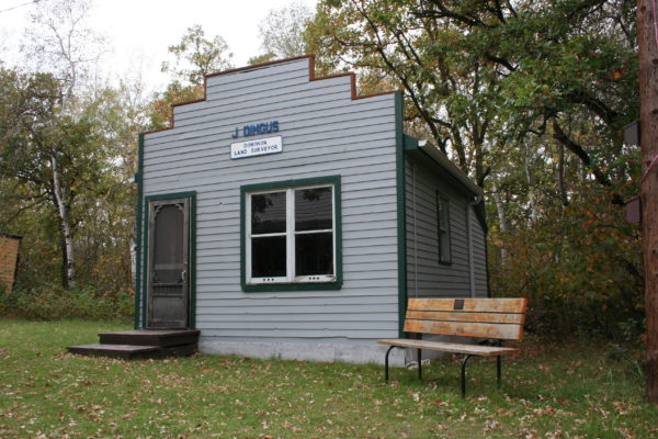
Welcome to a typical survey office from the late 1800s. It was from an office like this that surveyors managed the surveys of lands within early Manitoba. The earliest surveyors were men like David Thompson, Samuel Hearne and Peter Fidler who, equipped only with a sextant, trekked across the vast wilderness, observing the stars to determine their location and then drawing maps for use by their employers, the Hudson Bay Company and the North West Company. Later land surveys were made to establish lots for the settlers of the Red River Colony. These “River Lots” were narrow strips of land running at right angles to the river in order to address concerns for the welfare and protection of the early settlers in the isolated colony. The river frontage also provided ready access to the transportation arteries of the day. With the acquisition by the Dominion of Canada from the Hudson Bay Company of the huge tract of land known as Ruperts Land, the extension of confederation into the West could now begin. Faced with an anticipated massive and sudden settlement of the new lands and the need to manage it in an orderly and controlled manner and avoid the many problems inherent in a “land rush”, the Government determined that a simple and straightforward survey system was needed.
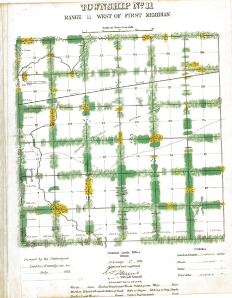
As a result, the survey and mapping of the new lands became a high priority. The system adopted was composed of 36 square mile Townships, each subdivided into 36 one mile square Sections of 640 acres each. Please see the attached Township Diagram of Township 11 Range 11 West. The Museum is in the West ½ of Section 17. The new system was to abut the existing River Lots and was to be referenced to a Principal Meridian which was established from a point on the International Boundary approximately 10 miles West of Emerson.
Between the years 1870 and 1885, millions of acres of Western Canada were surveyed and “posted”. This involved the placing of thousands of survey monuments. These early survey monuments consisted of a mound and 4 pits with a wooden post and were positioned at the intersection of the Northern and Eastern boundaries of each Section with the “Quarter lines” which divided each Section into 4 Quarter Sections of 160 acres. Into each post was carved the particulars of its location in the Section as well as its Township and Range reference. In later years the wood posts were replaced with iron posts which were stamped with the same kind of information. This information allowed settlers to readily identify the location of their new homesteads and to provide certainty when applications for Crown Grants were made. Samples of many of the types of monuments used over the years are on display here as well as a typical mound and pits which have been built just behind this building.
A major part of the settlement and development of the West was the construction of the trans-continental railroad. Suitable locations along the route were used as centers for the railway construction workers and engineers. Many of these sites gradually developed as people settled there and began working for the railroad or in related business. Surveys were carried out to create lots for these homes and businesses. Many of these early settlements still exist today with a common thread being the numerical street designations and the familiar “North and South Railway Avenues” linked by a “Main” or “Center Street”.
The methods and tools used in surveying have greatly changed over the years: the 66 foot “Gunters” chain and theodolite have been replaced by electronic equipment called Total Stations which measure distances and angles and digitally record the gathered information. Positioning on the ground by observations of the stars now mostly relies on man-made satellites and Global Positioning System (GPS) equipment.
The responsibility for surveys and surveyors, while originally the responsibility of the Dominion Government in support of the Property Rights system (Letters Patent and Crown Land Grants), now rests with the Association of Manitoba Land Surveyors, founded in 1881 under Provincial legislation to support the Provincial Real Property Act (Certificates of Title) and the Registry Act (Deeds to land) in Manitoba.
Additional information is available on the Manitoba Land Surveyors website.